Five technologies and innovations helping to protect the Okavango
From underwater vessels researching the ocean to satellite mapping of Earth’s little known regions, scientific exploration can now use technology to look before it leaps. Back in 2015, the National Geographic Okavango Wilderness Project carried out its first expedition of the source waters that supply the Okavango Delta—a mammoth wildlife survey across the Angola wilderness. Since then, the project has used vital tools and techniques to discover 52 new species and over 81 species potentially unknown to science, which further helps to build a case for conserving the entire Okavango River system. Now that De Beers has joined National Geographic through their Okavango Eternal partnership, research in this region is accelerating, and new discoveries await. Here are the top five technologies and innovations the partnership is using to help to explore the waters of the Okavango…
Water-monitoring technology
To understand how changes in the source waters could affect the Okavango Delta, scientists need to be able to detect subtle changes and compare them over time. To do this, Okavango Eternal is in the process of placing water-monitoring stations strategically along the rivers that run though Angola, Namibia, and Botswana into the Delta. Attached to a bridge or piece of infrastructure on the water, each station has a probe that measures water quality every hour, along with the water volume that flows through, and a weather station measures rainfall. Once all nine planned stations are in place, they should provide an unprecedented picture of the hydrology of the river system. Additionally, a separate device called an Acoustic Doppler Current Profiler allows scientists to collect “spot measurements” at different points in the river to track water volume changes; the device is pulled across the river while measuring water velocity to work out a volume of water moving through. Through a centralized, open-source app, scientists and people who rely on the annual flooding of the Delta can use this information to check timing and water levels—letting them make informed decisions on both local and national levels.
Environmental DNA (eDNA)
Conducting wildlife surveys has always presented a problem for biologists. Physically capturing live organisms can have a destructive environmental impact—not to mention smaller or elusive species are easy to miss. For such difficult species, eDNA changes everything. The technique relies on living things leaving traces as they move through a space: excretions or fragments of skin, hair, or scales. These traces can be picked up in random environmental samples, the DNA extracted, and the species that left it behind identified. The technique also works in water, as the DNA of aquatic creatures can be detected at very low concentrations, with viable elements able to last for up to 21 days in the wild. All scientists need do is push a sample of river water through a fine filter to capture genetic material, which is eventually sent to a lab to be identified. With sequencing becoming faster and cheaper to perform, eDNA is becoming an increasingly valuable tool for surveying the wild.
Broadband Global Area Network (BGAN) satellite internet
We all know the frustration of having no phone or internet signal when carrying out our daily lives, but in the Angola wilderness, the team has no standard connectivity for weeks at a time. Thankfully, BGAN satellite technology now offers a vital connection to the outside world. Standing for broadband global area network, these laptop-sized devices link directly to a satellite before emitting a Wi-Fi signal to which the expedition team can connect their phones and computers. BGAN has revolutionized the way that these expeditions are being managed, as it allows them to directly upload collected data at the end of each day—negating the need to store it on delicate hard drives and risk losing once-in-a-lifetime discoveries. BGAN is also vital for enabling team members to let their families know they’re safe, and keeping project base updated on their position for real-time progress tracking. The project can also organize resupplies en route as well as emergency assistance if needed based on these daily updates.
Smartphones and apps
The method of collecting data on an expedition has evolved massively over the decades. From paper and pencil to specialist software to everything now being accessible in the palm of a scientist’s hand. Smartphones have changed the lives of scientists in the field because now they can easily capture data quickly and efficiently. During biodiversity surveys, teams have their phones in hand for lightning-fast snaps of wildlife that would otherwise be missed. With an app, those images can also be collated and geotagged with exact locations before being added to the database automatically when the phone is connected to BGAN at the end of the day. Expensive satellite GPS units are also now a thing of the past, as team members are able to download satellite images of the area and orient themselves using their phones.
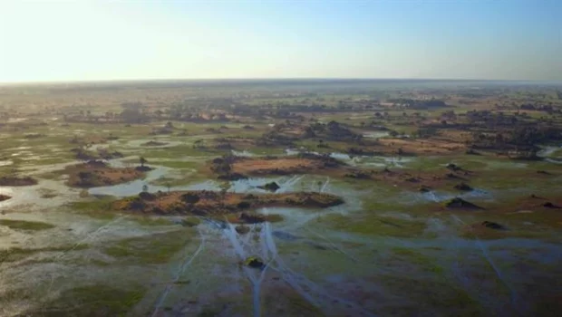
Drones
In the last 10 years, drones have decreased in size so that an expedition can now carry one along without having to worry about space or weight. Multirotor stabilization and automation mean drones can be thrown and caught from a canoe while moving along a river, and built-in, high-quality cameras let the team survey the area ahead. Drones are invaluable for mapping out topography in a region about which, scientifically speaking, relatively little is known. This means the team can scout ahead for any potential dangers, and document the condition of the landscape to help build a case for conservation. They can also scope out any potential biodiversity hotspots. Drones are also vital for storytelling on these expeditions, as National Geographic photographers can update social media feeds with stunning aerial images that capture the awe of places almost completely unknown to the wider world.
Find out more about how De Beers creates positive impacts here.


Gloss